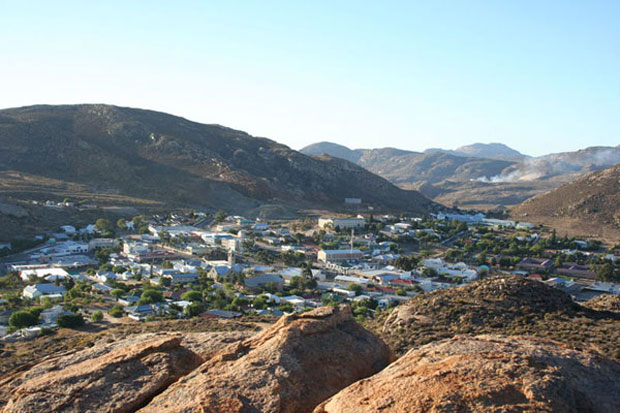
The town lies in a narrow valley between the high granite domes of the Klein Koperberge (Small Copper Mountains).
This name gives away the reason for the early settlement which gradually turned into a major commercial and administrative centre for copper mining operations in the region.
Springbok is a town with 14,580 inhabitants in the Northern Cape province of South Africa. It is the capital of Namaqualand and is located on the N7 which connects the Cape with Namibia.
The town lies in a narrow valley between the high granite domes of the Klein Koperberge (Small Copper Mountains). This name gives away the reason for the early settlement which gradually turned into a major commercial and administrative centre for copper mining operations in the region. Even though mining activities have dwindled, the town remains an important administrative capital in the region and due to its location a favourite stopover for tourists on their way to Namibia. Today the main income is generated from tourism, mining activities, commerce and farming.
The streets lead off from a central little koppie (hill) which now shows off Namaqualand’s strange flora, such as the almost leafless Quiver tree whose branches were used by Bushmen to hold their arrows. This area is famed for the incredible transformation which occurs every spring, when the near-lifeless scrub land explodes into colour from thousands of flowers hidden in the dry dusty earth, brought to life by winter rains.
The town was originally called Springbokfontein but the -fontein (fountain) was dropped in later years. The town was founded on the farm Melkboschkuil of one Kowie Cloete.
The "Klipkoppie" was used during the Second Boer War as a fort by the Boers under General Manie Maritz as it provided an excellent vantage point across the valley. Remains of stone walls inside the koppie can still be seen today. Next to the "Klipkoppie" and the Springbok Cafe is the beautiful Klipkerk (Stone Church) which was built in 1921.
Our Surroundings